High-Resolution Land-Use and Land-Cover Map around Nansei Islands, Japan 2024
(Released in March 2026 / 2024OKA_v26.03)
連絡先|Contact info.
伊藤 駿(いとう しゅん; Shun ITO)
所属(当時):筑波大学理工情報生命学術院 (Graduate School of Science and Technology, University of Tsukuba)
shun.ito1128[at]gmail.com
※送信時は [at] を @ に変更してください。When send e-mail, please chage [at] to @.
付記・免責事項: このプロダクトは, JAXA HRLULCのスピンオフ研究として, JAXA EORCおよびRESTECのご協力を頂きながら, 筑波大学として作成したものです。研究段階のものであり, 学術目的以外でのご利用は想定しておりません。従って, ご利用にあたっては, それに伴って生じうるいかなる損害についても, 筑波大学および作成者は責任を負わないことをあらかじめご承知ください。
Interactive Map Preview
You can switch background maps and toggle LULC visibility using the layer panel in the top-right corner.
Legend:
Download link
2024OKA_v26.03: 19 categories
Download (.zip)Category Definitions
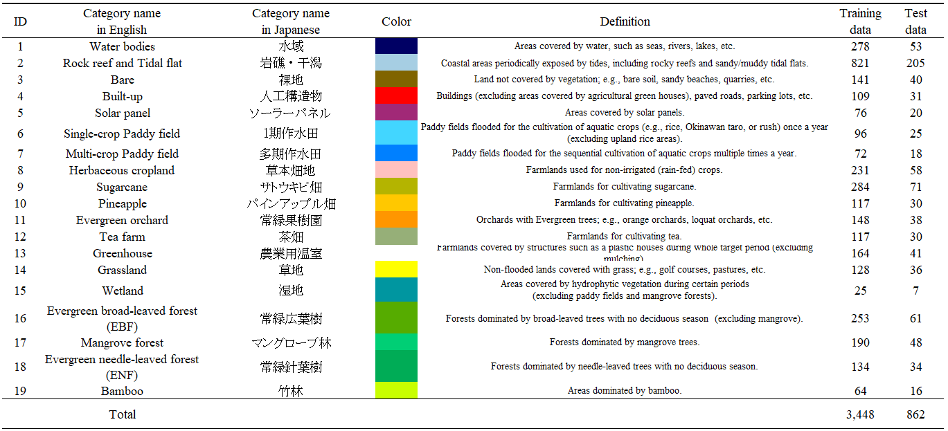
Figure 1: Definition and number of reference data for each category. Note that the original category “Cropland” in JAXA HRLULC-Japan has been renamed to “Herbaceous cropland” in this study, as woody crops (orchards) are segregated and classified as independent categories.
Input Data
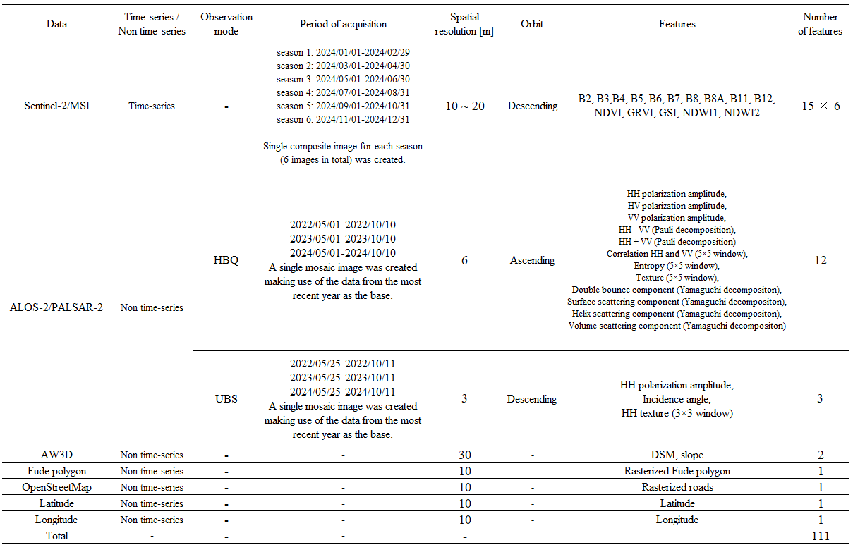
Figure 3: List of input data.
Classification Algorithm (SACLASS2.5)
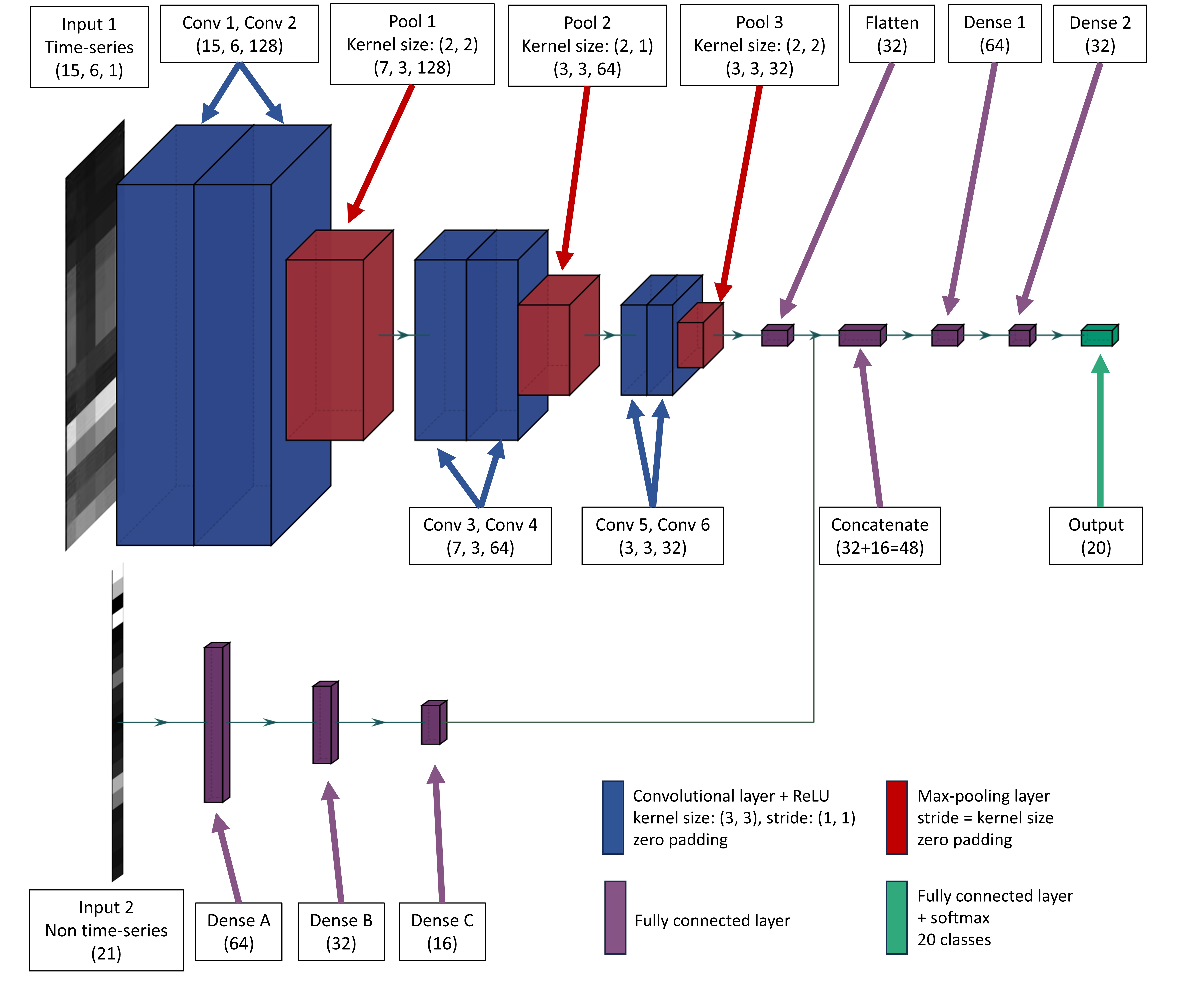
Figure 4: Processing flow of SACLASS2.5 developed by JAXA.
Accuracy Assessment
- Overall Accuracy: 90.6 ± 1.9 %
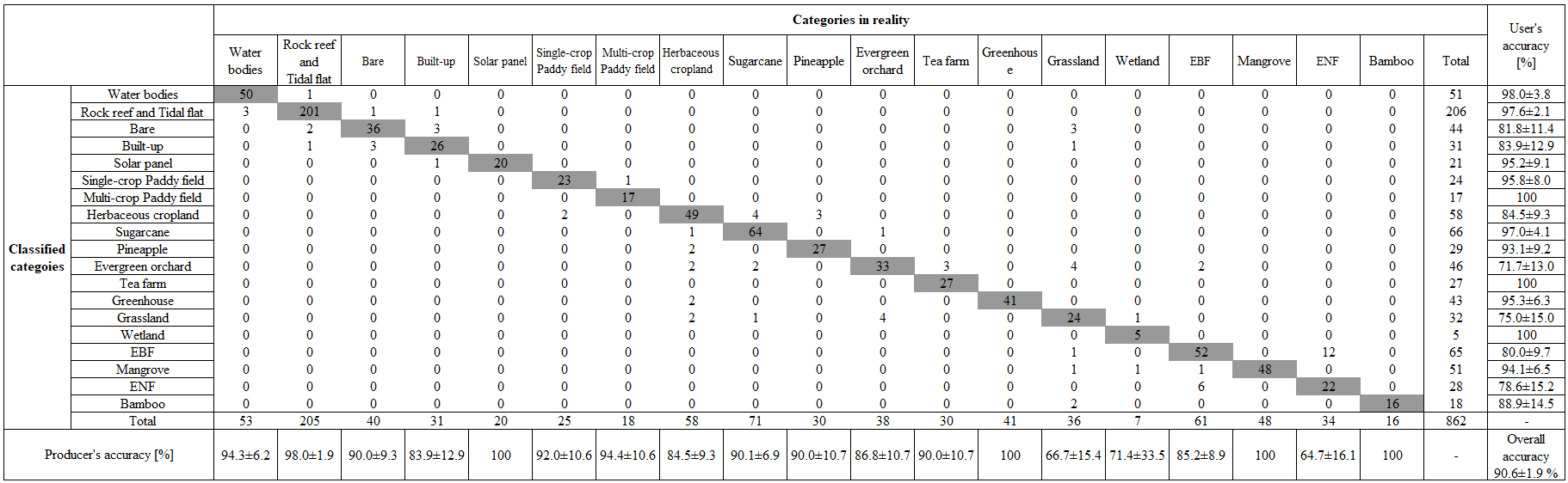
Figure 5a: Confusion matrix for 2024OKA_v26.04. Error bars represent the 95 % confidence interval.