HRLULC-Japan 2024 with Detailed Cropland
(Released in April 2026 / 2024JPN_v26.04_cropland)
連絡先|Contact info.
嶌田 将貴(しまだ しょうき; Shoki SHIMADA)
現所属:国立研究開発法人産業技術総合研究所地質情報研究部門
(Research Institute of Geology and Geoinformation, National Institute of Advanced Industrial Science and Technology)
shimada.shoki[at]aist.go.jp
※送信時は [at] を @ に変更してください。When send e-mail, please chage [at] to @.
本プロダクトについて | About this product: 2024JPN_v26.04_cropland
本プロダクトは2024年の日本全域(一部離島を除く)の状況を反映した日本域作付けマップバージョン26.04 (2024JPN_v26.04_cropland) です。 カテゴリ,使用データ,精度は以下をご覧ください。また,zipファイルの中にREADMEファイルが格納されていますので,そちらも併せてお読みください。今後はさらなるカテゴリの追加や高精度化,入力データの改良等に取り組んでまいります。
| 対象期間 | 2024年 |
|---|---|
| 座標系 | 等緯度経度座標系 (WGS84) |
| 格納単位 | 緯度経度1度単位のグリッドタイル, 12,000ピクセル × 12,000ライン |
| メッシュサイズ | (1/12,000) 度 × (1/12,000) 度 (およそ10 m × 10 m: 10 m解像度に相当) |
| ディレクトリ・ファイル 命名規約例 |
2024JPN_v26.04_cropland └── LC_N36E140_annualCropType.tif (上記の場合、2026年4月にリリースされた2024年の日本域を対象に作成されたプロダクトのうち、 北緯36から37度、東経140から141度の範囲を指します。) |
| 格納形式 | GeoTIFF形式 |
| ファイル数 | ファイル数: 100 タイル |
| 付記・免責事項 | このプロダクトは, JAXA HRLULC のスピンオフ研究として, JAXA EORCおよびRESTECのご協力を頂きながら, 筑波大学として作成したものです。研究段階のものであり, 学術目的以外でのご利用は想定しておりません。従って, ご利用にあたっては, それに伴って生じうるい>かなる損害についても, 筑波大学および作成者は責任を負わないことをあらかじめご承知ください。 |
Interactive Map Preview
You can switch background maps and toggle LULC visibility using the layer panel in the top-right corner.
Legend:
データのダウンロード|Download link
This product is available from following link. When use this, please cite following articles.
2024JPN_v26.04_cropland: 43 categories
Download (.zip): 183.8 MBカテゴリの定義|Category Definitions
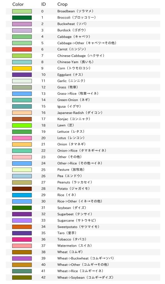
Table 1: Definition and number of reference data for each category.
精度評価|Accuracy Assessment
教師情報とは独立の検証情報を用いて, 43カテゴリの混同行列による精度検証を実施しました。以下に精度検証結果を示します。なお,精度検証については, 検証点がランダムサンプリングでない理由等で誤差が生じることをご留意ください。
- 全体精度 (OA: Overall Accuracy): 69 %
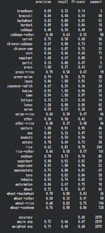
Table 2: Precision/Recall of the crop-classification.
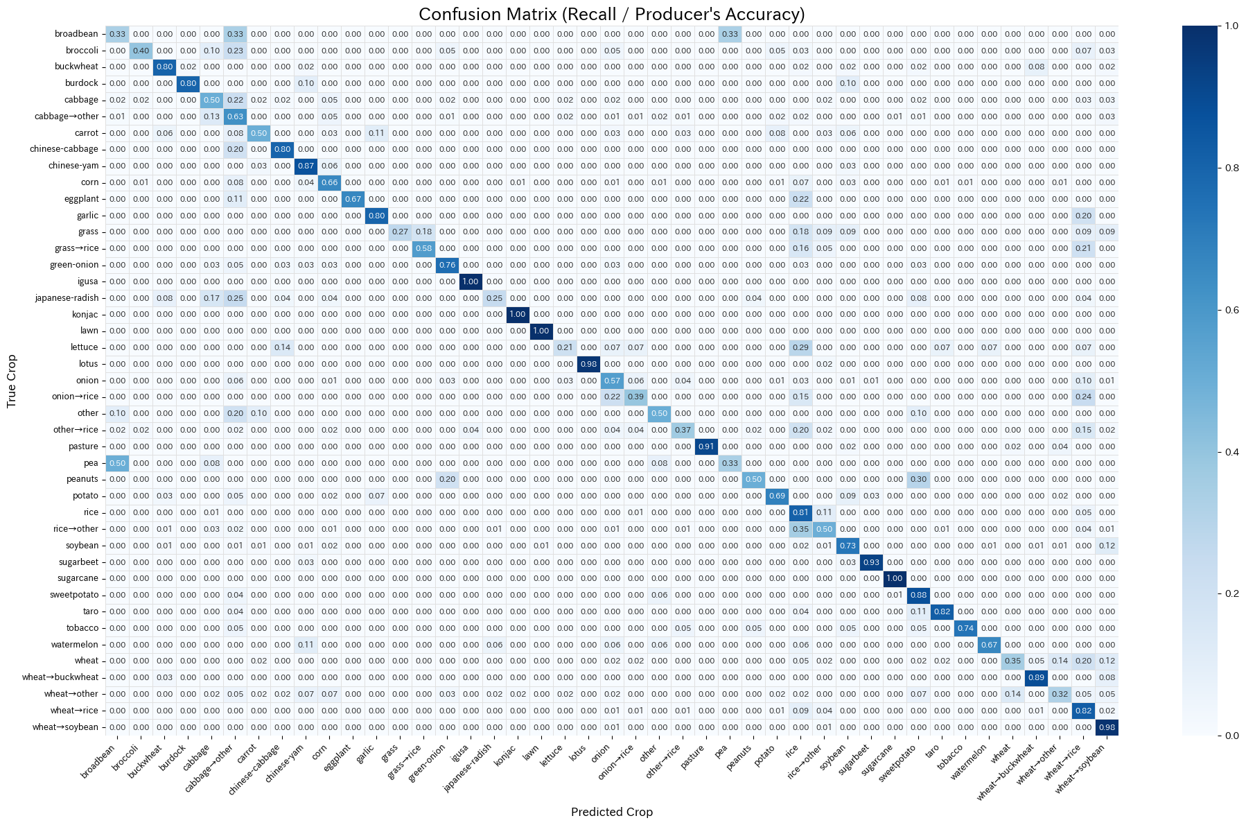
Table 3: Confusion matrix of the annual crop-category classification (Normalized by the “True” category).
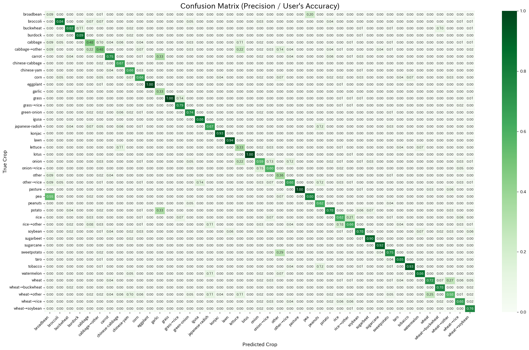
Table 4: Confusion matrix of the annual crop-category classification (Normalized by the “Predicted” category).
分類結果の概観|Regional Classification Results
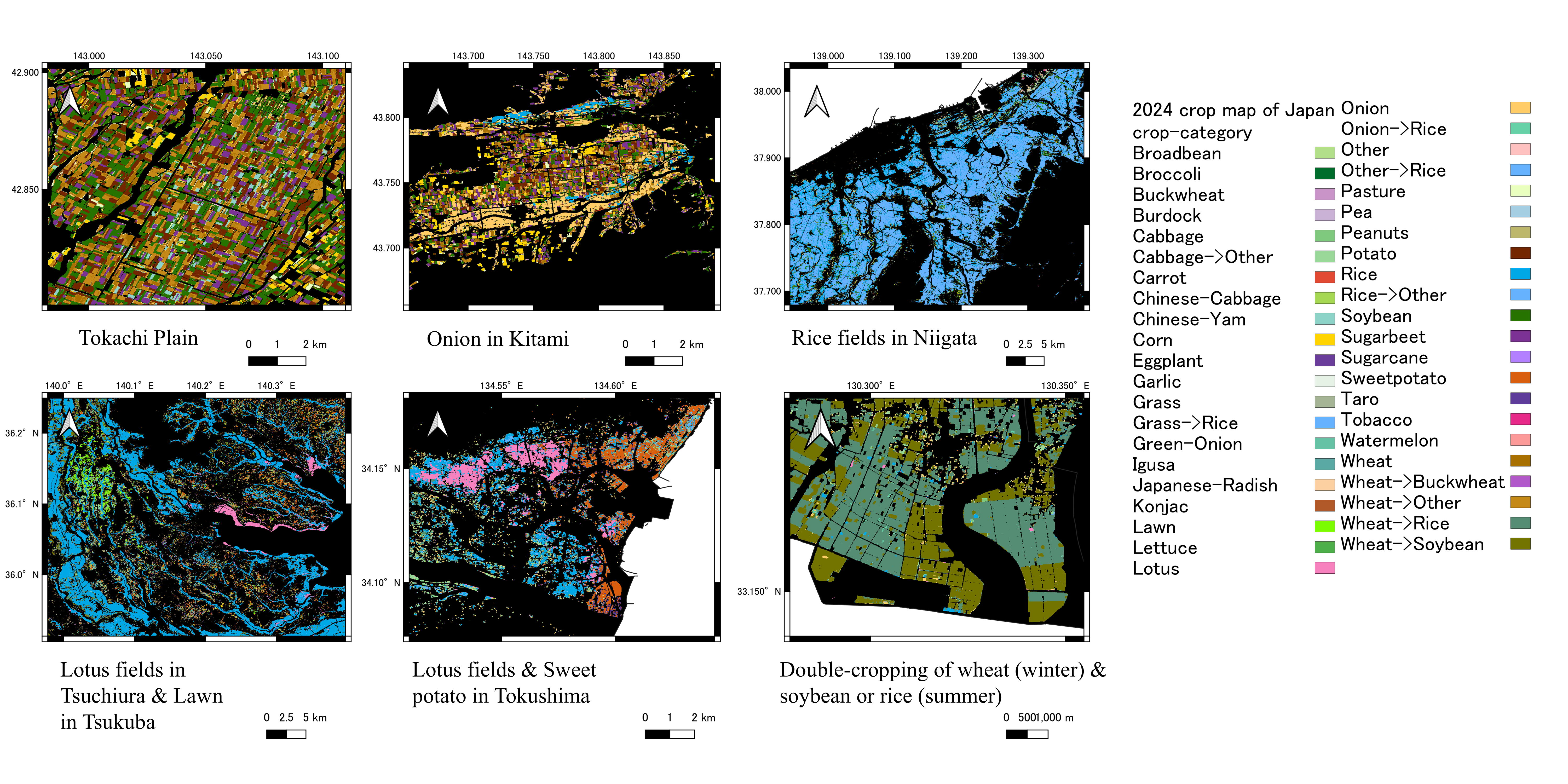
Figure 4: Regional results summary.