HRLULC-Japan 2024 with Detailed Vegetation
(Released in March 2026 / 2024JPN_v26.03_vegetation)
連絡先|Contact info.
水野 優輝(みずの ゆうき; Yuki MIZUNO)
所属:筑波大学理工情報生命学術院 (Graduate School of Science and Technology, University of Tsukuba)
mizuno.yuki.ryuiki[at]gmail.com
※送信時は [at] を @ に変更してください。When send e-mail, please chage [at] to @.
本プロダクトについて | About this product: 2024JPN_v26.03_vegetation
本プロダクトは2024年の日本全域(Sentinel-2衛星での観測頻度が不十分な一部の離島を除く)の状況を反映した日本域高解像度土地利用土地被覆/現存植生図バージョン26.03 (2024JPN_v26.03_vegetation) です。 カテゴリ,使用データ,精度は以下をご覧ください。また,zipファイルの中にREADMEファイルが格納されていますので,そちらも併せてお読みください。今後はさらなるカテゴリの追加や高精度化,入力データの改良等に取り組んでまいります。
| 対象期間 | 2024年 |
|---|---|
| 座標系 | 等緯度経度座標系 (WGS84) |
| 格納単位 | 緯度経度1度単位のグリッドタイル, 12,000ピクセル × 12,000ライン |
| メッシュサイズ | (1/12,000) 度 × (1/12,000) 度 (およそ10 m × 10 m: 10 m解像度に相当) |
| ディレクトリ・ファイル 命名規約例 |
2024JPN_v26.03_vegetation └── LC_N36E140_vegetation.tif (上記の場合、2026年3月にリリースされた2024年の日本域を対象に作成されたプロダクトのうち、 北緯36から37度、東経140から141度の範囲を指します。) |
| 格納形式 | GeoTIFF形式 |
| ファイル数 | ファイル数: 118 タイル
以上に加え,マジョリティリサンプリングによる100 m, 250 m, 500 m, 1000 m解像度相当のファイルも含まれています。用途に合わせてご利用ください。 |
| 付記・免責事項 | このプロダクトは, JAXA HRLULCのスピンオフ研究として, JAXA EORCおよびRESTECのご協力を頂きながら, 筑波大学として作成したものです。研究段階のものであり, 学術目的以外でのご利用は想定しておりません。従って, ご利用にあたっては, それに伴って生じうるい>かなる損害についても, 筑波大学および作成者は責任を負わないことをあらかじめご承知ください。 |
Interactive Map Preview
You can switch background maps and toggle LULC visibility using the layer panel in the top-right corner.
Legend:
データのダウンロード|Download link
This product is available from following link. When use this, please cite the following article.
[Eng. ver.] Mizuno, Y., Ito, S., Matsui, T., Kobayashi, Y., Kitamura, K., Sugai, T., Yokoyama, J., Hirayama, S., Shimada, S., Tadono, T., Tachikawa, H., Kurata, S., Hirota, M., Hirade, N., Nagata, Y., Yamane, K. and Nasahara, K. N. Development of High-Resolution Actual Vegetation Map of Japan from Satellite Remote Sensing, Journal of The Remote Sensing Society of Japan (Under review)
2024JPN_v26.03_vegetation: 30 categories (10 m, 100 m, 250 m, 500 m, 1000 m version are included in this zip file)
Download (.zip): 683.9 MBカテゴリの定義|Category Definitions
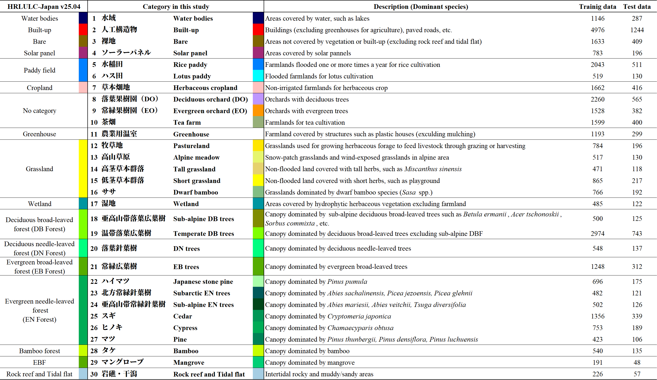
Table 1: Definition and number of reference data for each category. Note that the original category “Cropland” in JAXA HRLULC-Japan has been renamed to “Herbaceous cropland” in this study, as woody crops (orchards) are segregated and classified as independent categories.
使用データ|Input Data
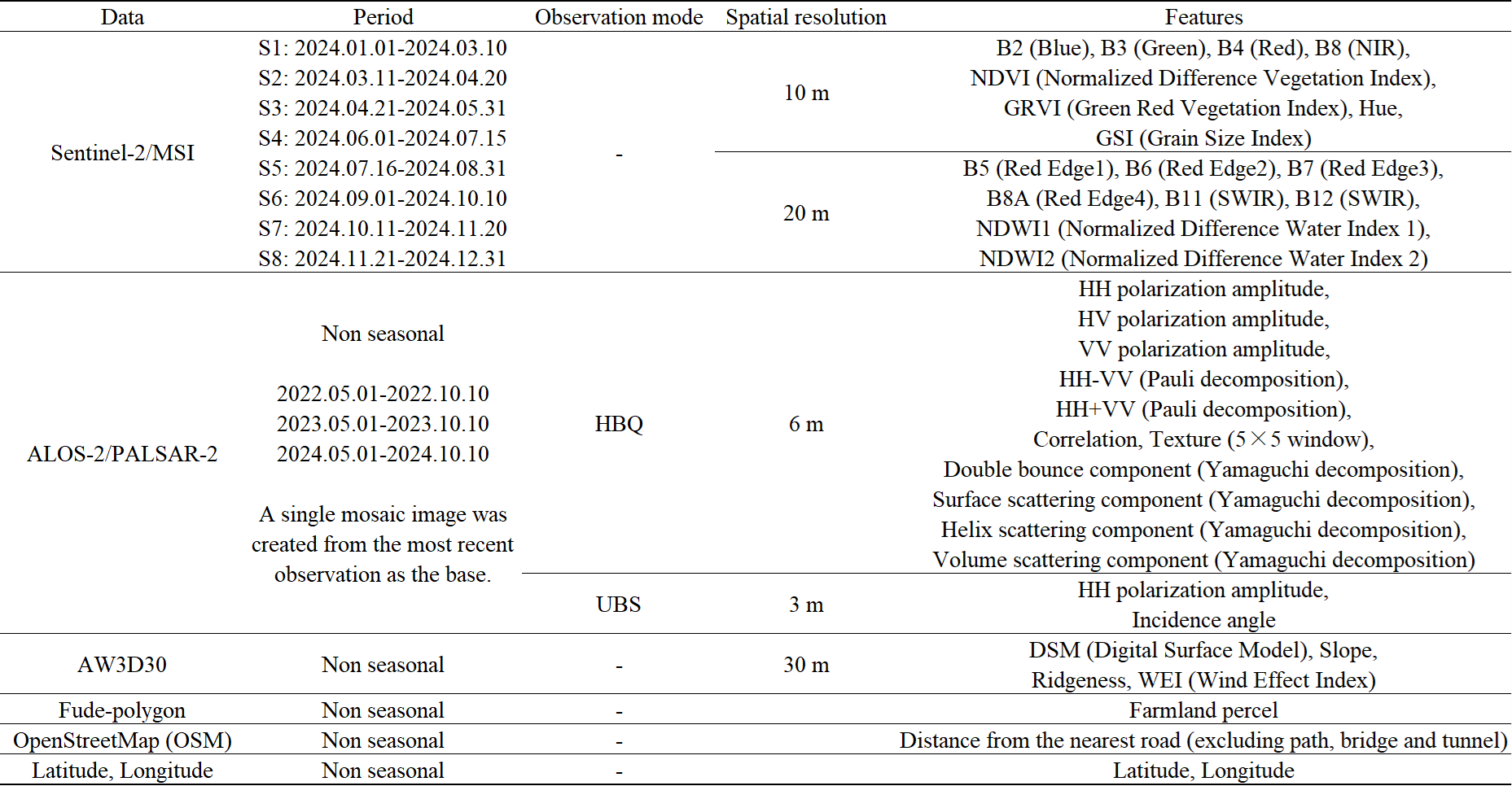
Table 2: List of input data. We used Level-2A product for Sentinel-2/MSI.
精度評価|Accuracy Assessment
教師情報とは独立の検証情報を用いて, 30カテゴリの混同行列による精度検証を実施しました。以下に精度検証結果を示します。なお,精度検証については, 検証点がランダムサンプリングでない理由等で誤差が生じることをご留意ください。
- 全体精度 (OA: Overall Accuracy): 96.3 ± 0.4 %
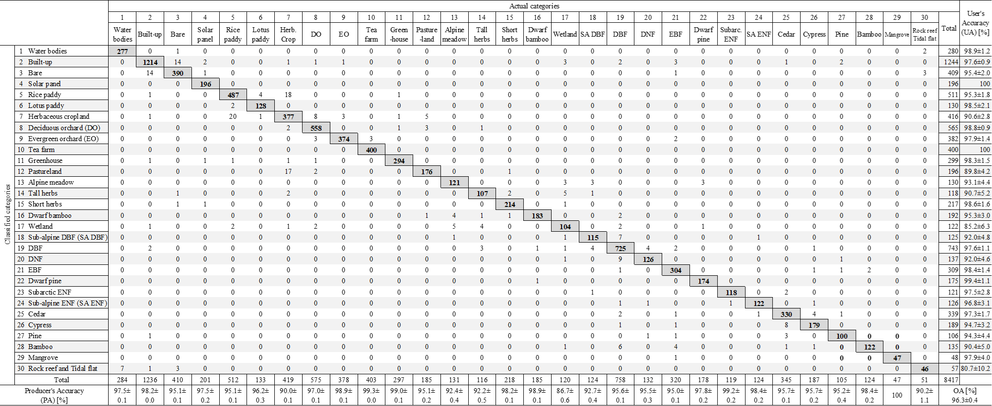
Table 3: Confusion matrix. Error bars represent the 95 % confidence interval. Test data was not collected using random sampling; therefore actual accuracy can be different from this.
分類結果の概観|Regional Classification Results
Comparison of JAXA HRLULC-Japan 2024JPN_v25.04 and the output of this study
Category in JAXA HRLULC-Japan: Please see Table 1 (left column)
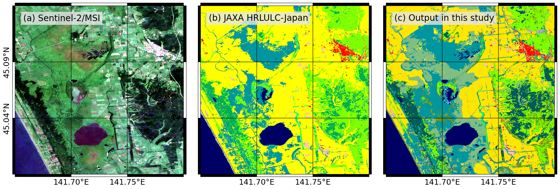
Figure 4a: Sarobetsu wetland (Hokkaido).
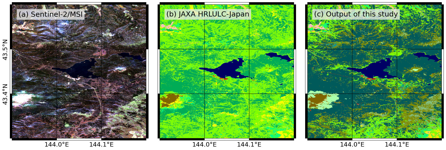
Figure 4b: Mt. Meakan (Hokkaido).
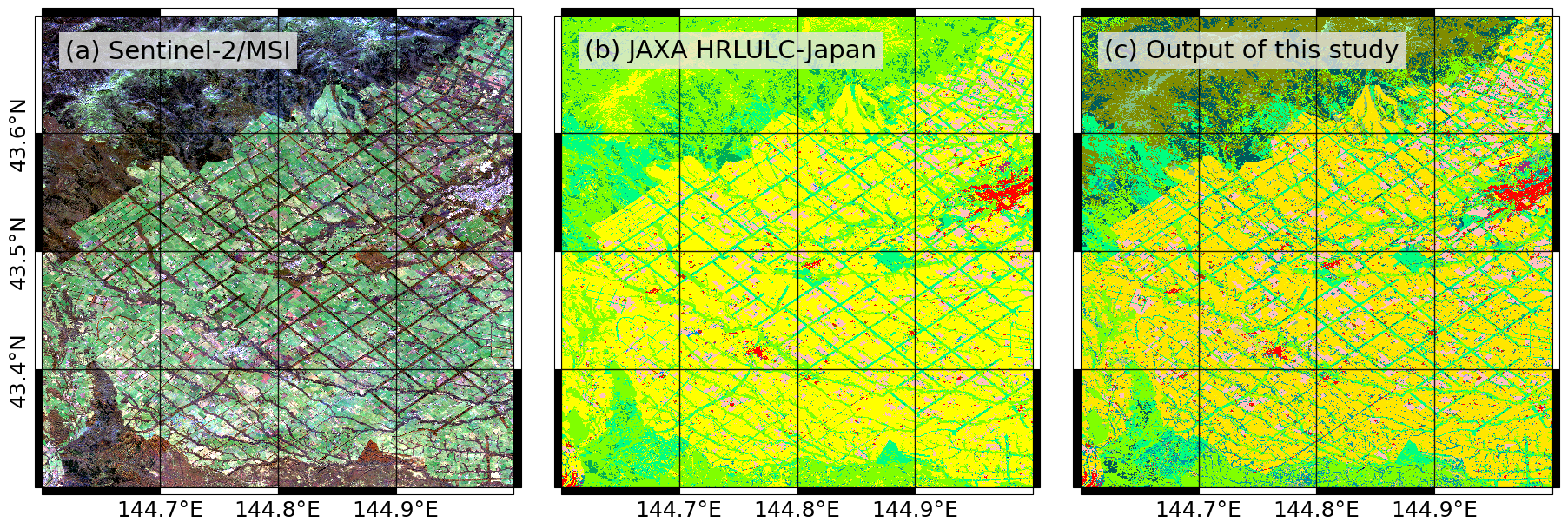
Figure 4c: Around Betsukai town.
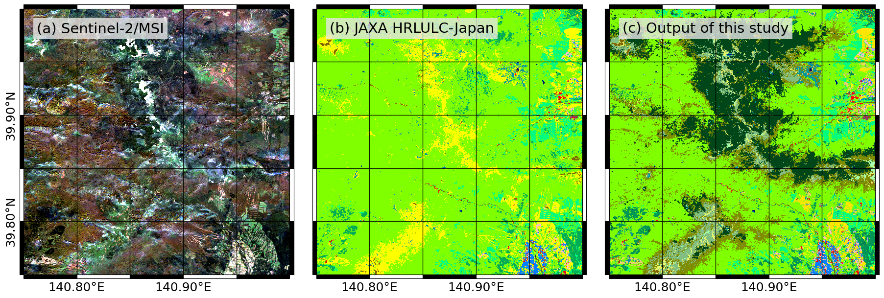
Figure 4d: Hachimantai and Mt. Akita-Komagatake (Akita and Iwate).
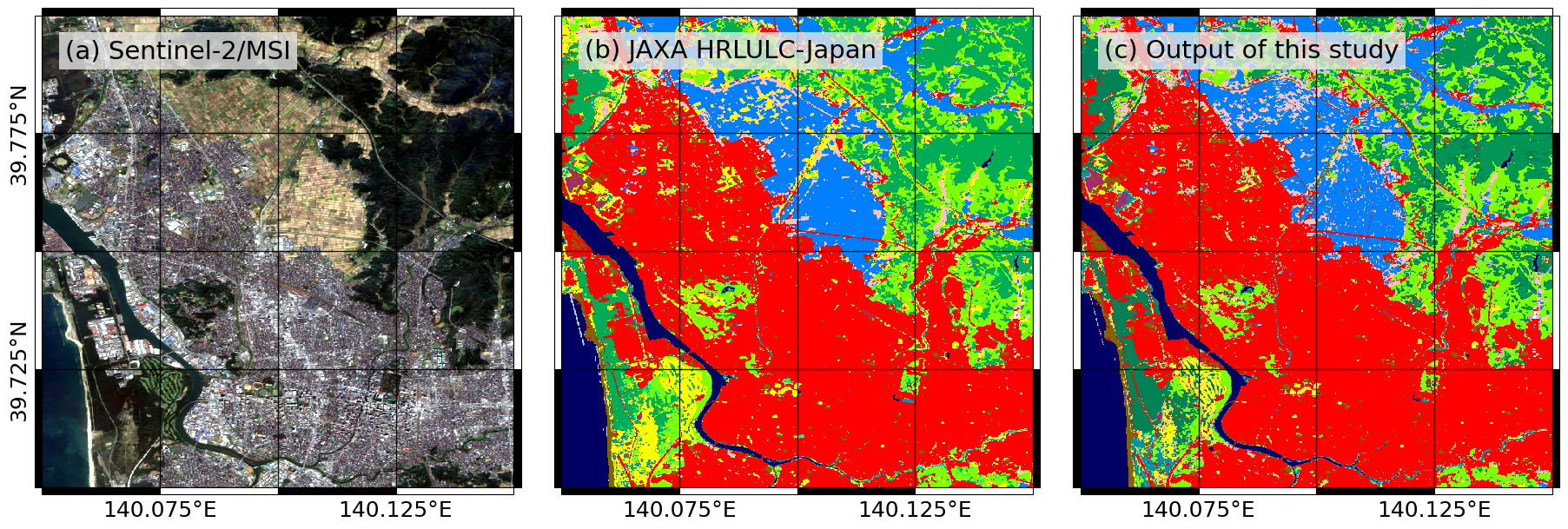
Figure 4e: Coastal area in Akita.
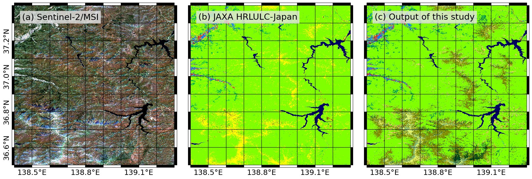
Figure 4f: Around Mt. Tanigawadake (Gunma and Nigata).
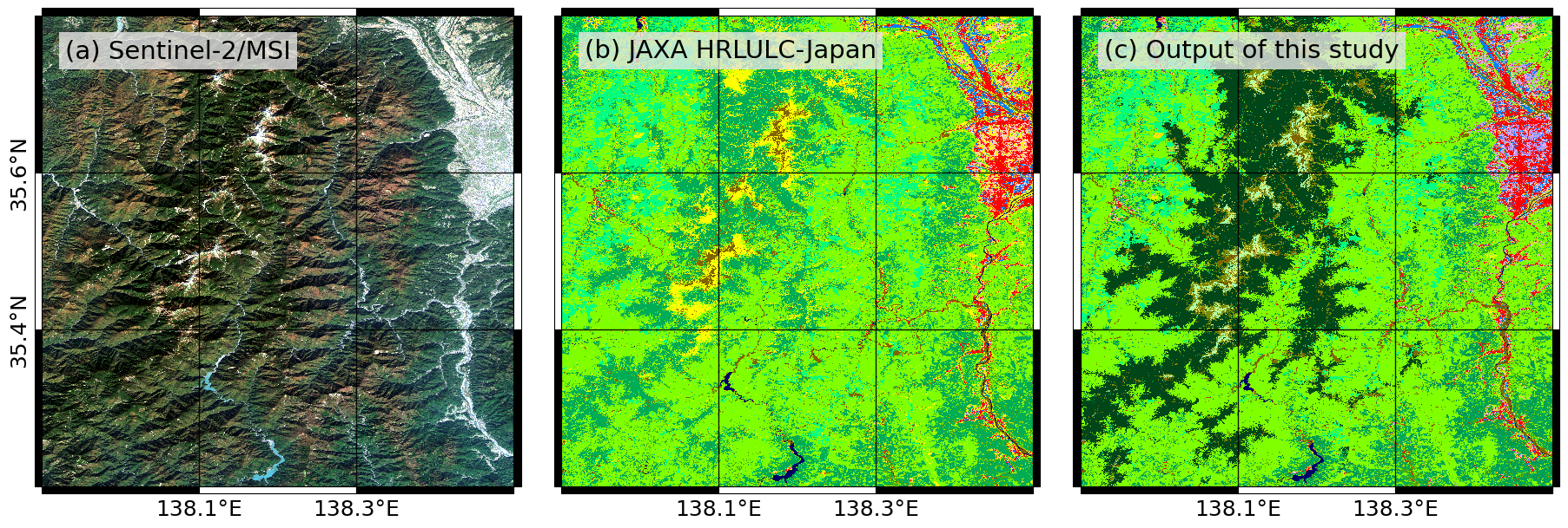
Figure 4g: South alps mountains.
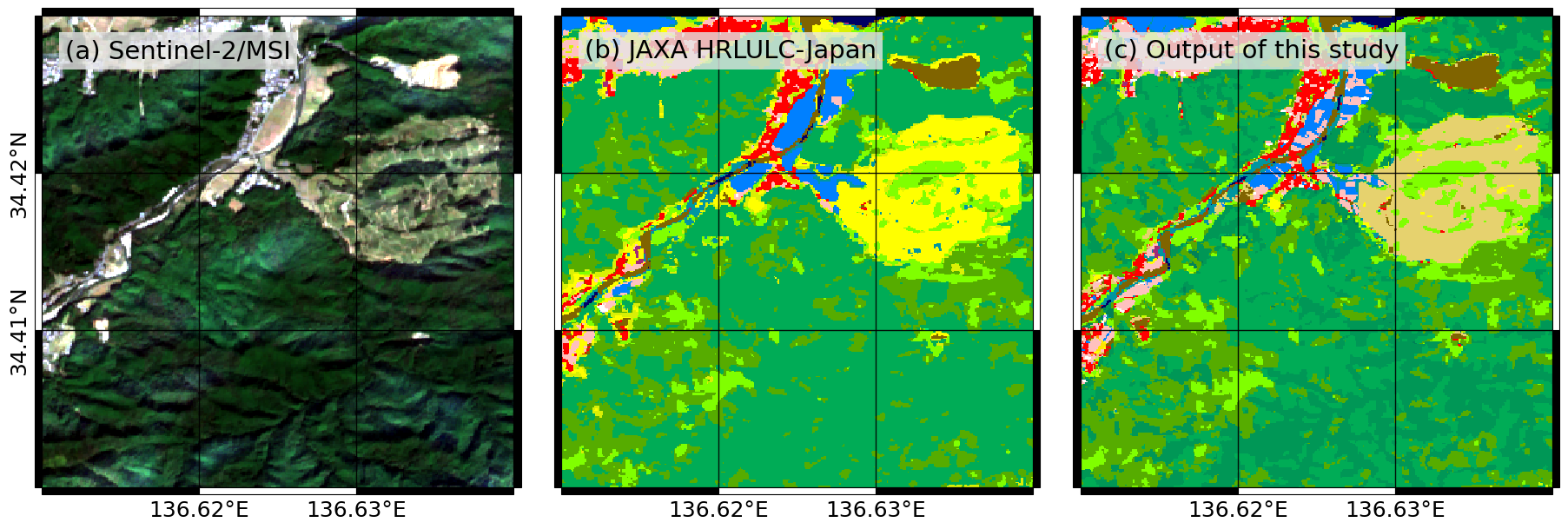
Figure 4h: Kayaba in Kawaguchi (Mie).
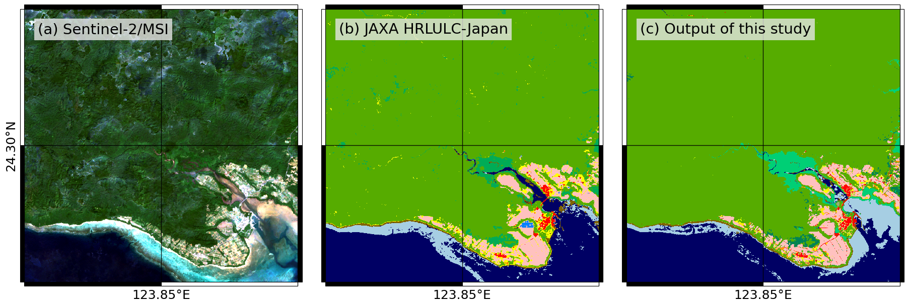
Figure 4i: Iriomote Island (Okinawa).