High-Resolution Land-Use and Land-Cover Map of Bangladesh [2020・2023]
(Released in September 2025 / 2020BGD_v25.09 & 2023BGD_v25.09)
Published Paper: Sarker, M.M. et al. (2025). The First National-Scale High-Resolution Land Use Land Cover Map of Bangladesh Using Multi-Temporal Optical and SAR Imagery. Earth, 6, 143. https://doi.org/10.3390/earth6040143
Interactive Map Preview
Switch between 2020 and 2023 versions using the layer panel. Default: 2023 version.
Legend:
Download link
2020BGD_v25.09: 14 categories
Download (.zip)2023BGD_v25.09: 14 categories
Download (.zip)Category Definitions
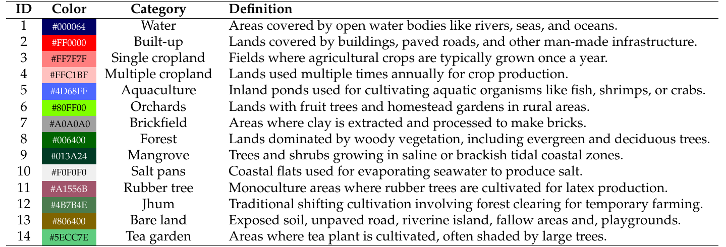
Figure 1: Definition of the 14 classification categories for HRLULC-Bangladesh.
Classification Methodology
The map was generated using the classifier "SACLASS2" developed by JAXA, integrating multi-temporal Sentinel-2/MSI optical data and ALOS-2/PALSAR-2 SAR data. This approach captures the distinct phenological characteristics of South Asian agricultural cycles.
Accuracy Assessment
The national-scale map achieved robust overall accuracy across both periods, validating the reliability of multi-temporal satellite data integration.
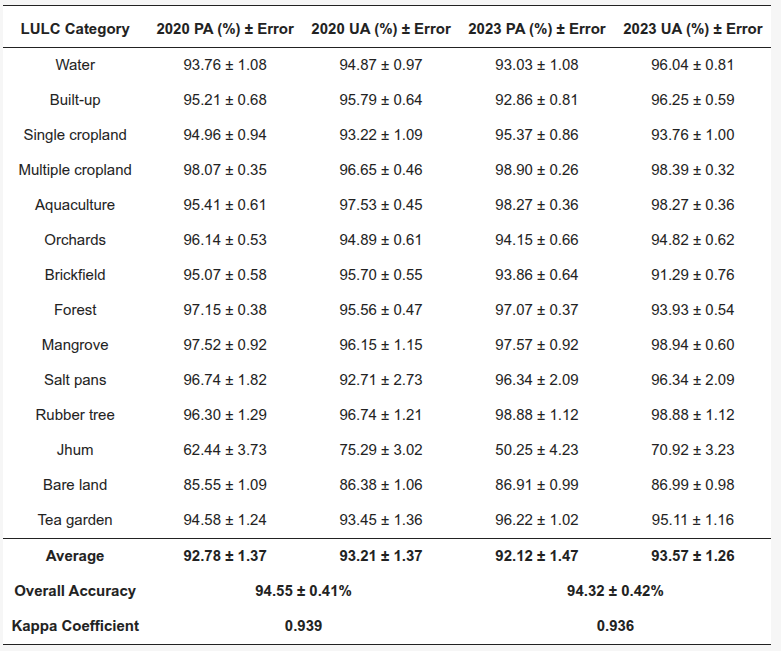
Figure 2: Comparison of producer accuracy (PA) and user accuracy (UA) with 95% confidence intervals across different LULC categories for the years 2020 and 2023.